
Joshua Fry and Peter Jefferson’s Map of the Inhabited Part of Virginia, containing the whole of the Province of Maryland with Part of Pennsylvania, New Jersey and North Carolina, first published by Thomas Jefferys in London in 1753 (Figure 1) is one of the most celebrated maps in American history.[1] [2] Much of the map’s luster comes from its association with Thomas Jefferson, the son of one of the map’s makers. Among its other distinctions, it is the “basic cartographical document for Virginia of the eighteenth century [and] the first map of Virginia by Virginians.”[3] It is in fact one of the stellar cultural artifacts to issue from colonial Virginia.
![Fig. 1: "A Map of the Inhabited part of Virginia, containing the whole province of Maryland with Part of Pensilvania, New Jersey and North Carolina" drawn by Joshua Fry and Peter Jefferson, 1751, published by Thomas Jefferys, August 1753 (State 1), London. HOA: 30-3/4"; WOA: 47-1/4". University of Virginia Library, Special Collections, Accession #A 1751 .F79 (available online: http://search.lib.virginia.edu/catalog/uva-lib:1003260/view [accessed 4 September 2013]).](https://www.mesdajournal.org/wp-content/blogs.dir/23/files/taliaferro-2013/taliaferro-fig-01.jpg)
Figure 1
While much has been written about Fry and Jefferson’s map, most of the literature does little more than echo earlier commentary. The exception is Cooley Verner’s definitive essay, published in Imago Mundi in 1967.[4] In the decades since, further information has accrued that now demands a re-assessment of the map’s origins and early history.
Verner argued that Fry and Jefferson were closely involved in the preparation of the map, to the point of submitting new data about Virginia’s western lands to be incorporated into the printed map (which Thomas Jefferys issued in January 1755). We now know, through understanding how a 1751 sketch map of the upper Ohio Valley traveled from the frontier of North America to Thomas Jefferys’s London workshop, that Verner’s assumptions about the relationship of colonial surveyors and London publishers were inappropriate.
Further, a previously unknown early state of Fry and Jefferson’s printed map has been identified—a state that requires a reconsideration of the map’s cartobibliography.[5] The older bibliography by Henry Stevens and Roland Tree, from 1951, is still followed by some, despite being superseded by Verner.[6] Both cartobibliographies need to be corrected and brought into alignment (see Appendix A and Appendix B).
These and other discoveries have led to a re-assessment of our political and cultural interpretation of the Fry and Jefferson map, of some of its fundamental characteristics, and its relationship to other colonial maps of the period.
The Political Origins of Fry and Jefferson’s Map, 1751
An international crisis was the catalyst for the publication of Fry and Jefferson’s map as well as several important related maps, notably John Mitchell’s Map of the British French Dominions in North America (London, 1755) (Figure 2) and Lewis Evans’s Map of the Middle British Colonies (Philadelphia, 1755) (Figure 3).[7] From the perspective of North America, it was a struggle between Great Britain and France for control of the interior of the continent, a contest that was ultimately resolved in Britain’s favor by the French and Indian War (1754–1759), part of a greater global conflict known as the Seven Years’ War (1755–1763).
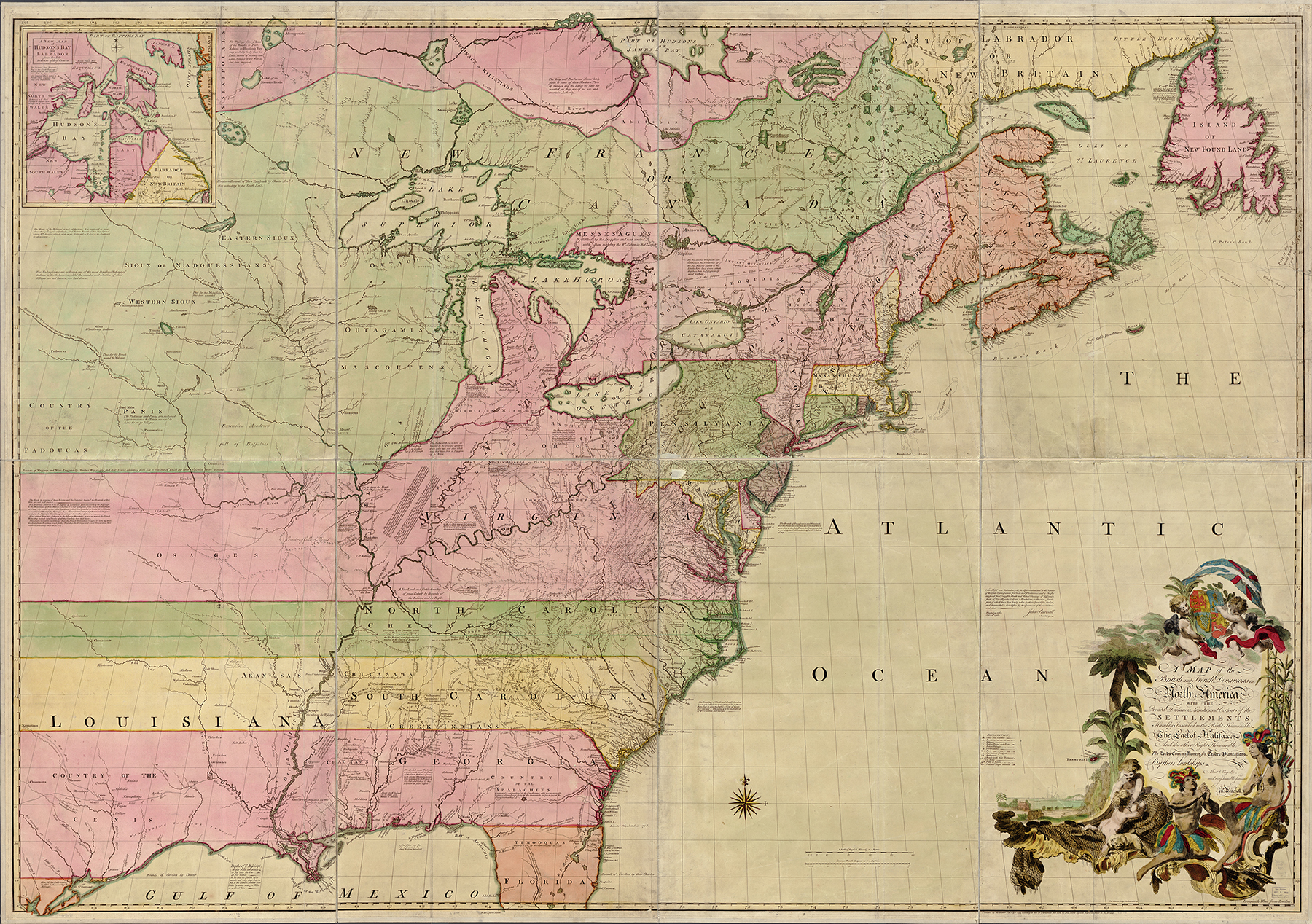 Figure 2 |
![Fig. 3: “A General MAP of the MIDDLE BRITISH COLONIES, in AMERICA…” by Lewis Evans, 1755, engraved by James Turner, Philadelphia, PA. HOA: 22"; WOA: 29-1/2". Library of Virginia, G3710 1755 .E8 Voorhees Collection (available online: http://digitool1.lva.lib.va.us:8881/R/A3HVK9V649I1K8B3M3RI5K8GFGIT7Y1F7STDT2HBDGTGHITC2C-02217?func=dbin-jump-full&object_id=14989&pds_handle=GUEST [accessed 4 September 2013]).](https://www.mesdajournal.org/wp-content/blogs.dir/23/files/taliaferro-2013/taliaferro-fig-03.jpg) Figure 3 |
The crucial issue of the war was control of the upper Ohio Valley, a region that surrounds the Ohio River in what is today the states of Pennsylvania, Ohio, West Virginia, and Kentucky. As early as 1745, Virginia land speculators were obtaining grants of land in the upper Ohio Valley. The most important and among the earliest of these speculators was the Ohio Company of Virginia. Formed by a group of magnates from the Northern Neck of Virginia in 1747, the company originally petitioned the colonial government for 500,000 acres to be laid out along the upper Ohio River and its tributaries, the Monongahela and Youghiogheny.[8] Competing with the Ohio Company was a group known as the Loyal Company, which had obtained 800,000 acres south of the Ohio River in 1749. Among the members of Loyal Company were Joshua Fry and Peter Jefferson.[9]
Prosecution of the war was complicated by the British government’s decision-making process for the colonies, which in the mid-eighteenth century was still decentralized and distributed haphazardly among a number of agencies. Ultimate responsibility lay with the King, acting in accord with the Privy Council (the King-in-Council). Specific responsibility was vested in the Secretary of State for the Southern Department, who was a member of both the Privy Council and the parallel institution of the Cabinet, which advised the Prime Minister and executed his agenda. Actual oversight of the colonies fell to a lower-level institution, the Lord Commissioners of Trade and Plantations, also known as the Board of Trade. The principal role of the Board of Trade was to collect information and advise the Privy Council on colonial affairs. Among its duties was the solicitation and subsequent evaluation of maps and surveys sent to London by the colonial governors and knowledgeable individuals. Once such maps were in the Board of Trade’s possession, they became official documents and were stored in its cartographic archives.[10]
By 1749, George Montagu-Dunk, 2nd Earl of Halifax (Figure 4), who served as president of the Board of Trade from 1748 to 1761, was alarmed at the possibility that France might seize the Ohio Valley. He wanted a map that would show the relative position of the two nations in North America and substantiate Britain’s claim to the disputed territory. Through a process that is not totally understood, Halifax selected Dr. John Mitchell to compile a general map of North America and gave him access to the Board of Trade’s cartographic archives to bring the project to fruition.[11]
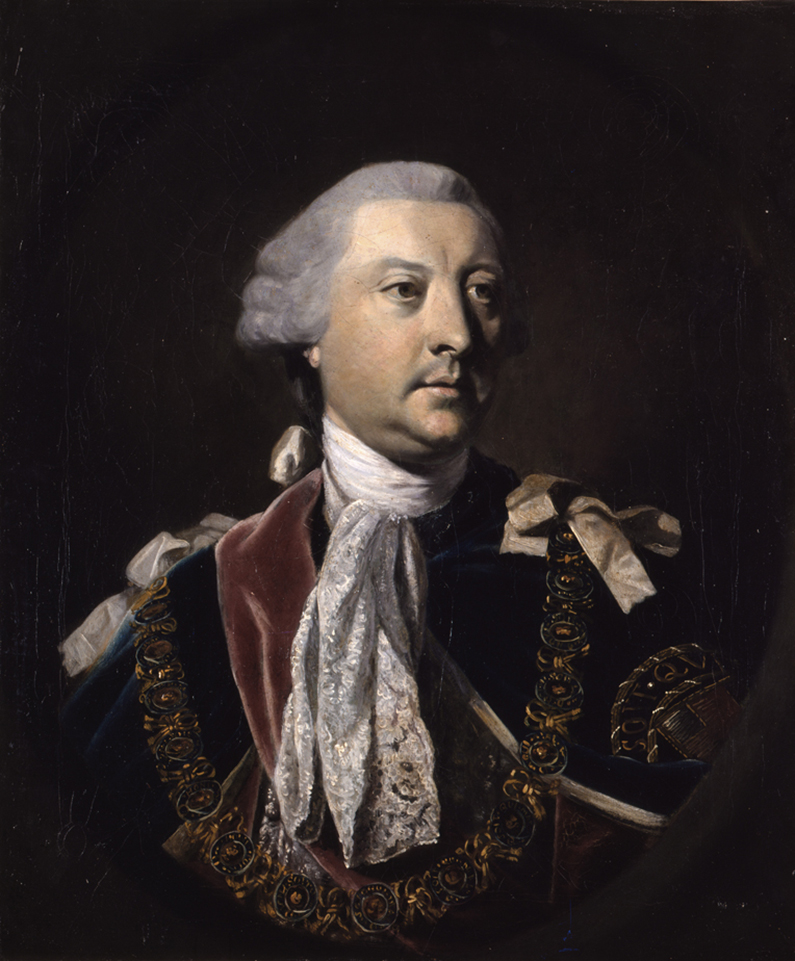
Figure 4
John Mitchell was a Virginian who had studied medicine at Edinburgh. He was internationally recognized for his research in a number of branches of science, particularly botany, and counted among his friends and correspondents such men as Benjamin Franklin, Cadwallader Colden, John Bartram, Mark Catesby, Peter Collinson, and Linnaeus. Due to ill health, Mitchell left Virginia for London in 1746, where he immediately entered into the intellectual life of the city. As a Virginian, Mitchell had long been concerned about French activities in the Ohio Valley.[12] He apparently began to study existing maps shortly after his arrival in London. At some point he was introduced to Halifax who was evidently impressed and asked Mitchell to prepare the map of North America.[13]
The respective histories of John Mitchell’s Map of the British and French Dominions in North America and Fry and Jefferson’s map intersect at a number of points. In 1750, Mitchell submitted a first manuscript of his map to the Board of Trade. Its inadequacies cast an unflattering light on the usefulness of the board’s cartographic archive. Shortly after, on 18 July 1750, the board ordered that an urgent directive be sent to all North American governors requiring that they forward a general map of their colony to London. The directive produced surprisingly few results; the most promising came from Virginia, where the acting governor, Lewis Burwell, informed the Board of Trade on 15 January 1751, that he had selected “the most able persons,” Joshua Fry and his associate, Peter Jefferson, to construct a map of that colony.[14]
The Original Fry and Jefferson Manuscript and the 1753 Printings
Colonel Joshua Fry was born in England, studied at Oxford, and came to Virginia around 1720. Like many young residents of the colony, Fry came into a substantial fortune by marrying an heiress. He was the first professor of mathematics at the College of William and Mary and subsequently moved to the Virginia frontier, to what became Albemarle County in 1744, where he served as magistrate and burgess. He was also chief surveyor for the county, with Peter Jefferson as his assistant. Jefferson had previously held the office of chief surveyor for Goochland County, Virginia, but when the western part of that county, where both Fry and Jefferson lived, became Albemarle County, Fry was evidently judged to be the more accomplished of the two and was given precedence as chief surveyor. The relationship between the two men quickly evolved into a form of partnership, but one in which Fry was the dominant element.[15] Fry and Jefferson were highly involved in the two great surveying projects for the colony of the period—of such importance that the projects were instrumental in Fry and Jefferson’s subsequent appointment to make the map of Virginia.
In 1746, Fry had been appointed one of the commissioners for the Colony of Virginia to survey the back line of the Fairfax Grant, with Jefferson acting as one of the surveyors. In the following year, Peter Jefferson, in partnership with Robert Brooke, completed a draft of the entire Northern Neck of Virginia, based on actual survey, which laid down the back line (Figure 5). Three years later, Fry and Jefferson were sent to survey an extension to the Virginia-North Carolina boundary, or “Dividing Line,” and prepared a map that included the boundary’s entire length (Figure 6).[16]
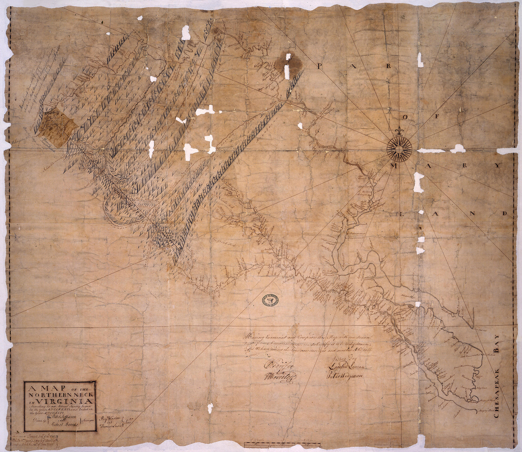 Figure 5 |
![Fig. 6: Manuscript map of the border between Virginia and North Carolina as surveyed in 1728 (by William Byrd, et al) and 1749 (by Joshua Fry and Peter Jefferson). HOA: 12-3/16", WOA: 75-3/16". University of Virginia Library, Special Collections, Accession #38-628 (available online: http://search.lib.virginia.edu/catalog/u2717833 [accessed 4 September 2013]).](/files/Taliaferro-Fig-06.jpg) Figure 6 |
Fry and Jefferson’s first manuscript map (or “draught”) of Virginia was completed during the summer of 1751 and sent to London on 21 August of that year. It was accompanied by a report on the “Back Settlements of Virginia,” written by Joshua Fry, dated 8 May 1751, which was an argument supporting Virginia’s (and therefore Britain’s) claim to territory as far west as the Mississippi River. The manuscript map and report reached the Board of Trade on 9 December 1751, and were examined on 11 March 1752. They were then given to John Mitchell for evaluation. Mitchell incorporated information from both the manuscript map and Fry’s report onto his (Mitchell’s) map of North America and submitted an analysis of the report to the board on 15 April 1752.
In his analysis, Mitchell emphasized “Virginia’s particular potential to withstand the French encroachments in the Ohio Valley,”[17] a point that presumably induced Halifax to have Fry and Jefferson’s map printed by Thomas Jefferys in late August 1753.[18] Map scholar Matthew Edney noted in his 2008 Imago Mundi article on Mitchell’s map that the “obsequiousness” of the dedication to Halifax on the printed map suggests that Halifax was behind its publication.[19] Any doubt about the Board of Trade’s role in bringing Fry and Jefferson’s map to market is put to rest by an advertisement—not cited by previous scholars—for the map’s 4 December 1753 printing, its true second state, which specifically declared that it was published “By permission of the Righ[t] Hon. The Lords Commissioners of Trade and Plantations.”[20]
Fry and Jefferson’s surveys of the Northern Neck and the Virginia-North Carolina boundary line were the framework upon which the remainder of their map of Virginia was hinged—otherwise, we can only speculate as to their sources (Figure 7).[21] In his January 1751 letter to the Board of Trade that accompanied Fry and Jefferson’s manuscript map and Fry’s report, Virginia’s acting governor Lewis Burwell commented only that as “we are yet a country of woods, it is surprising that he [Fry] could draw so beautiful a map of it.”[22] Cooley Verner provided no further explanation in his 1967 Imago Mundi article, writing only that Fry and Jefferson had “copies of their own previous work”—meaning the surveys of the Northern Neck and the boundary line—as well as “a goodly supply of material relative to the country east of the Blue Ridge.” In his latter statement, Verner is merely paraphrasing Thomas Jefferson, who in his autobiography wrote that “they possessed excellent materials for so much of the country as is below the blue ridge; little being the known beyond that ridge.”[23] Other than Fry and Jefferson’s earlier surveys, Verner was uncertain about the sources for the remainder of the map.
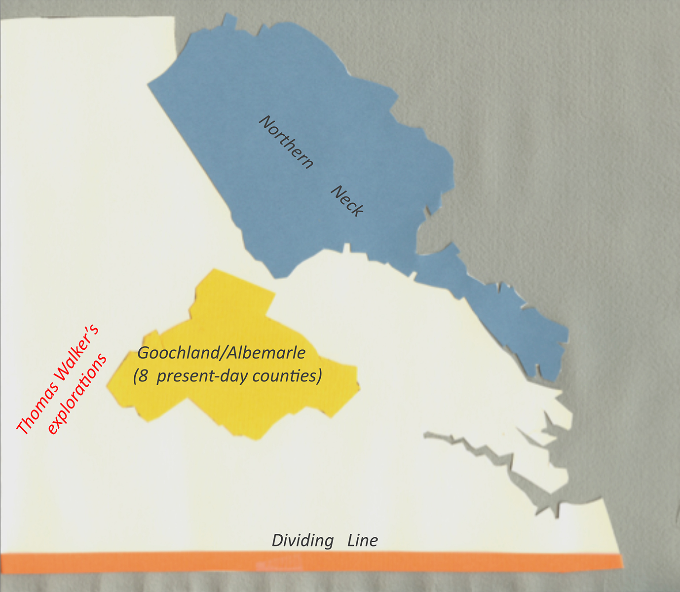
Figure 7
The construction of the map apparently only took about four months, so there was no time for any new first-hand surveys.[24] In 1738, Fry, with William Mayo and Robert Brooke, had proposed to the Assembly to make an exact survey of the colony and print and publish a map thereof. Although nothing came of it, in all probability some draughts were made which were made use of in 1751.[25] Fry and Jefferson must have also solicited sketch maps, surveys, written descriptions, and other information from county surveyors and other contacts throughout Virginia. Both men were well connected, and most of the leading men in the colony must have been eager to see the project succeed. Solicitation of this sort was a fundamental tool for the construction of eighteenth century maps. It was used by William Gerard de Brahm, for example, when he constructed A Map of South Carolina and a Part of Georgia (London, 1757) (Figure 8). De Brahm ran an ad in the South Carolina Gazette in 1752, addressed “to all Gentlemen, who desire to have their particular plantations inserted [on the map], that they will be pleased to send Copies of their respective plats… .”[26]
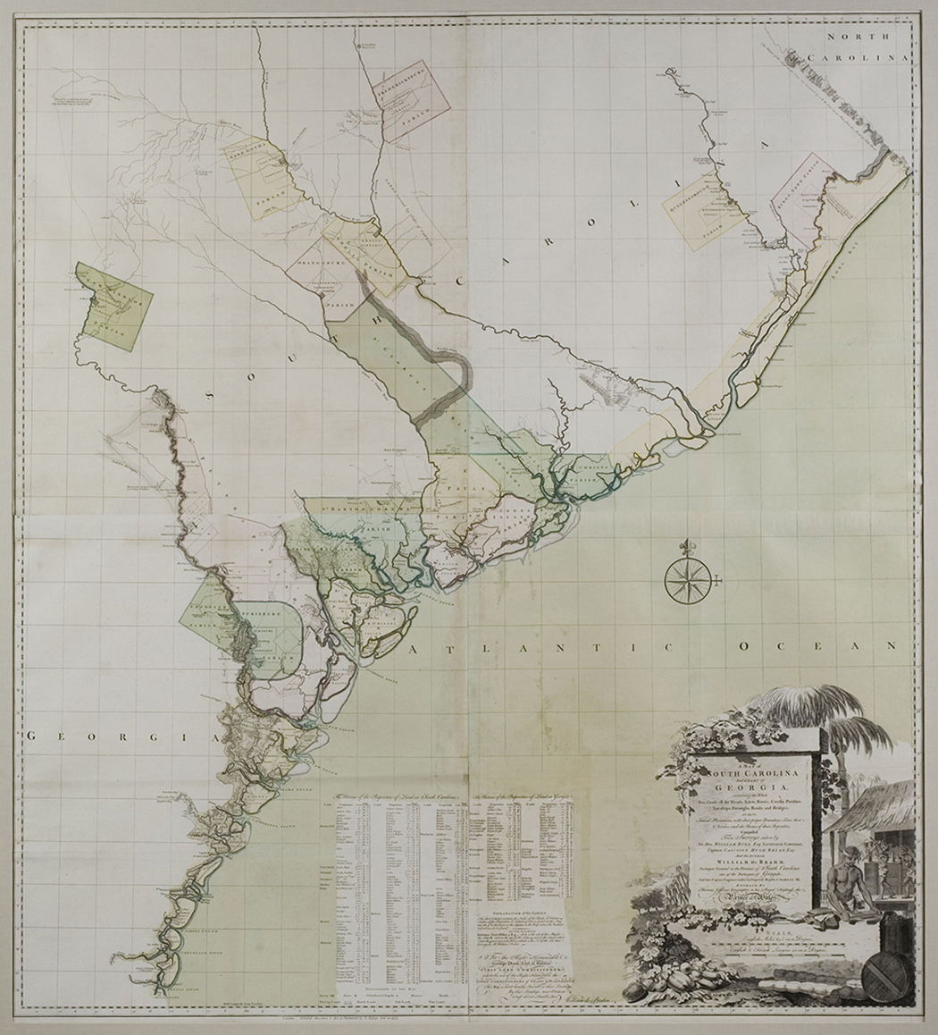
Figure 8
As late as the nineteenth century, solicitation was used to complete the great nine-sheet Boye map of Virginia.[27] Late in his life, Thomas Jefferson was a driving force behind the making of the nine-sheet map. Jefferson was an avid promoter and collector of maps; a love that must have been augmented if not inspired by witnessing his father and Joshua Fry construct their map.[28] Thomas Jefferson was responsible for the appointment of John Wood as the original surveyor for the nine-sheet map, and Jefferson continually made suggestions as to the best methods for its construction. In August 1819, for example, Jefferson wrote to Wood: “Your letter of July 27 has been received here, with queries proposed for Bedford and Albemarle counties. In the former county I am so total a stranger… I will put it into the hands of someone better acquainted… with the county. I shall not return until autumn to Albemarle. I must therefore inclose that paper to Colo. Randolph, who knows better than I do who, there, may be most likely to collect the material you desire [author’s emphasis].”[29]
Thomas Jefferson may have suggested this method of solicitation to John Wood, perhaps recalling its use by his father and Joshua Fry almost seventy years earlier. In fact, there is at least one surviving record of such a solicitation for the construction of the Fry and Jefferson: On 26 March 1751, Fry’s close friend, the Reverend Robert Rose, noted in his diary that he “Rode to Col. Fry’s for a visit and lay down Tye River on ye map of Virginia.”[30]
The Board of Trade’s desperation to procure a document that supported British territorial claims against the French led Fry and Jefferson’s first manuscript map to be sent to London, in the words of a contemporary observer, “without the finishing touch.”[31] As the manuscript does not survive, Cooley Verner concluded that all we can know of it has to be surmised from the contents of the map’s first printing of August 1753.[32] But we know from a remark in Joshua Fry’s May 1751 report that the manuscript extended much farther west than the 1753 printed map, perhaps as far as the Mississippi River.[33] The manuscript map, therefore, fulfilled the Board of Trade’s desire for a map of the unsettled lands over which the British were competing with the French. When Thomas Jefferys engraved the Fry and Jefferson map for publication, however, he omitted the westernmost part included in the manuscript in favor of a more manageable format and the advantage of a larger scale for eastern Virginia (see Fig. 1). In addition, contemporary references make it clear that Fry and Jefferson’s original 1751 manuscript included only land assigned to Virginia under its charter; the included parts of the neighboring colonies were added from various sources to the printed version in 1753 at the workshop of the publisher, Thomas Jefferys.[34]
Thomas Jefferys began his career as an engraver, but quickly established himself as one of London’s leading map publishers (Figure 9). The date when Jefferys’s special relationship with the Board of Trade began has been a matter of some debate. One noted scholar suggested that his “semi-official standing” was the result of his appointment as Geographer to the King in December 1760.[35] Another scholar, J. B. Harley, believed Jefferys’s access to the board’s cartographic archives, “denied to his competitors,” began with the success of his famous map and memoir on Nova Scotia, published in May 1755. In fact Harley finds no direct evidence of a special relationship prior to 1761.[36] As will be explained, we now know that this relationship existed much earlier, with the August 1753 printing of Fry and Jefferson’s map of Virginia. The question of how Jefferys established his affiliation with the Board of Trade remains unanswered.
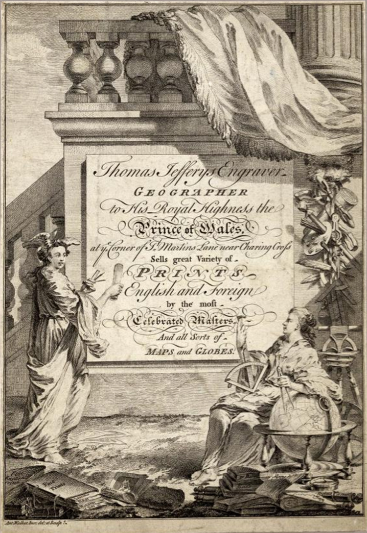
Figure 9
It has been suggested that this first printing of the Fry and Jefferson map of Virginia was intended for limited use by officials and select individuals rather than for general distribution. The initial cost of production argues against such a hypothesis. The lavish cartouche, for example, which appeared on the August 1753 and all subsequent printings, was designed by Francis Hayman and engraved by Charles Grignion, luminaries of the London art world (Figure 10).[37] Such an embellishment would have been an extravagant and unnecessary expense for a map printed in a limited number for strictly utilitarian purposes. By the summer of 1753, the escalating tension with France had apparently increased the topicality of colonial maps to such an extent that Jefferys most likely added the cartouche to the Fry and Jefferson to broaden its appeal to the general market.
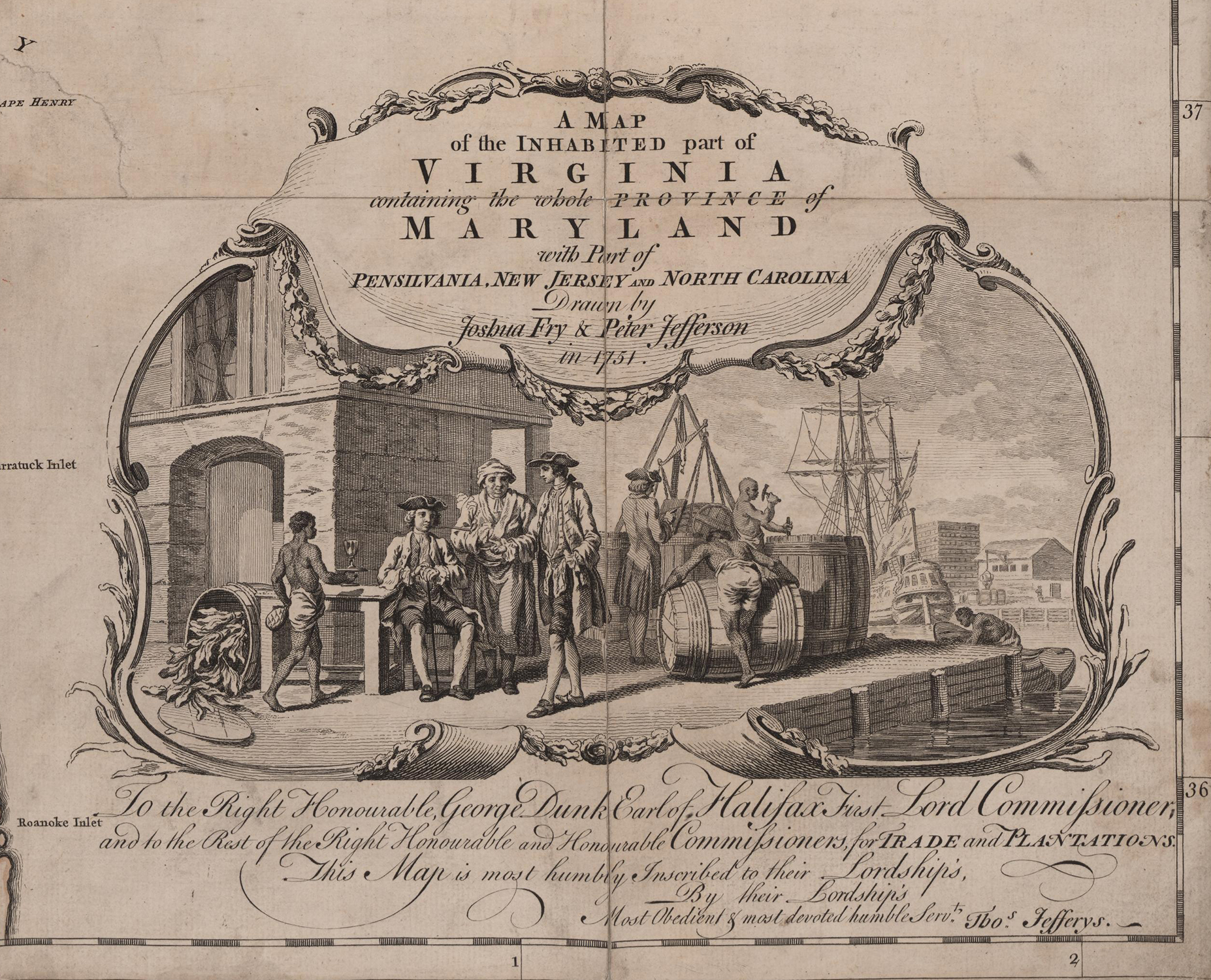
Figure 10
As noted earlier, on 4 December 1753, a little over three months after the map’s initial printing, an advertisement placed in the London Public Advertiser by Jefferys described a previously unknown new state of the map:
This Day is published, By Permission of the Righ Hon. the Lords Commissioners of Trade and Plantations, A MAP of the most inhabited Part of VIRGINIA, containing the whole Province of Maryland, with Part of Pennsylvania, New Jersey and North Carolina. Drawn by JOSHUA FRY and Peter JEFFERSON. Engraved and published by Tho. Jefferys, Geographer to his Royal Highness the Prince of Wales, at Charing Cross; and sold by W. Clarke, under the Royal Exchange, in Threadneedle-street. Where may be had, The New Chart of America, in six Sheets.[38]
Neither Henry Stevens and Roland Tree nor Cooley Verner were aware of this, the true second state, when they compiled their cartobibliographies of the map. Verner had concluded that the January 1755 state (Verner’s second) was the first to incorporate the major western revisions, and to add the word “most” to the title.[39] He was correct in the first instance, but wrong with the second. Jefferys’s December 1753 advertisement gives the title as “A MAP of the most inhabited Part of VIRGINIA,” thus the change in the title took place over a year earlier than Verner thought and establishes a previously unknown state of the map published between the initial printing in August 1753 and the January 1755 state (see Appendix A and Appendix B).
Adding the word “most” to the map’s title was necessary due to Jefferys’s decision to discard the draught’s far western part when he engraved the plates in 1753. At that time, Jefferys retained Fry and Jefferson’s original title, “A Map of the Inhabited Part…,” a title that seemed odd as it was initially applied to a map that may have extended as far west as the Mississippi River. Fry’s decision to include the word “Inhabited” in the title of the draught was a political choice.[40] It supported Britain’s claim to all the territory assigned to Virginia under its charter through the fiction that English settlement extended as far as the colony’s westernmost limits when in fact it was clustered in the easternmost regions. After the map was published without its western part, it must have occurred to Jefferys (or Halifax) that the title, as it stood, implied that all settlement was confined to the eastern (“Inhabited”) part of Virginia and that the discarded western lands were wholly uninhabited. The addition of the word “Most” to the title of the December 1753 state of map corrected the oversight.[41]
The December 1753 state may be the map that the Reverend Matthew Maury described in a 1755 letter to a British correspondent. Maury noted, “In the map, I perceive the name of a river erased, emptying into New River… The word erased I guess to be Yokegheny.”[42] It is significant that the map Maury described in his letter showed the Youghiogheny River flowing into the New River and that the river’s name was erased. On the August 1753 state of the map, the river is shown flowing into the New River, as Maury noted about his map, but the name of the river is present (spelled “Yougougain”). The name of the Youghiogheny River also appears on the January 1755 state of the map, but the river is depicted flowing into the Monongahela River, not the New River. The map that Maury described matches neither the August 1753 state nor the January 1755 state—or any other recorded printed copies of the map. It could be that Maury’s map and the December 1753 state of the map were one in the same; unfortunately, no copies of the December 1753 state of the Fry and Jefferson map are known to survive to comprehensively compare with Maury’s description, thus it is impossible to be certain.[43]
Verner pointed out that “after the first draught of the map had been sent to London in the summer of 1751, Fry and Jefferson made a second and revised draught,” which arrived in London too late to be incorporated in the first published version of the map.[44] Verner speculated that this second draught had revisions for Virginia east of the Blue Ridge Mountains, including the first depiction of Virginia’s road system, and that the revisions may have been added to the plates before the new western material arrived. Verner concluded that “If this occurred there is an as yet undiscovered state of the plate.” Circumstantial evidence suggests that Verner was correct. Fry and Jefferson’s map was the first to include Virginia’s road system. The third printing of January 1755 is the earliest surviving version of the map to include this network (Figures 11 and 12). John Mitchell’s map shows Virginia’s roads in a virtually identical form, but due to the respective chronology of their printing, it is highly unlikely that the January 1755 state of Fry and Jefferson’s map was the source of Mitchell’s information. Mitchell must have found his depiction of the roads in some other source, which can only have been Fry and Jefferson’s revised draught or the December 1753 printing, the second state of the map.[45]
 Figure 11 |
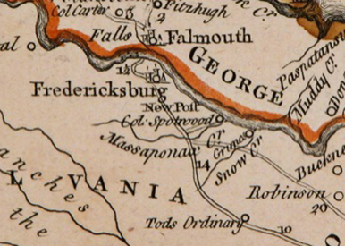 Figure 12 |
The Revisions to the January 1755 State of the Map
The third state of January 1755 is extraordinary (Figure 13), with the significant additions to the two eastern (right-hand) sheets and a complete reworking of the western (left-hand) sheets. The latter reflect the momentous increase in geographical knowledge for the Ohio Valley region between 1751 and the summer of 1754. Fry and Jefferson were responsible for the changes to the eastern sheets, which must have been taken from their second draught and may have been present on the December 1753 second state. In addition to Virginia’s road system, they corrected a number of place names and added landmarks such as taverns.
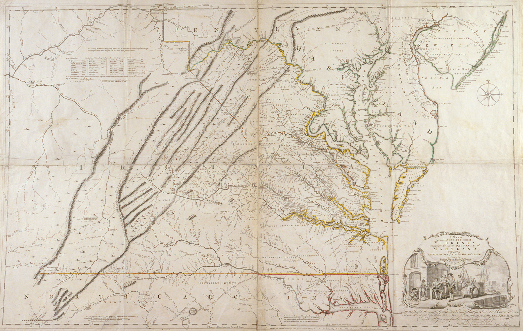 Figure 13 |
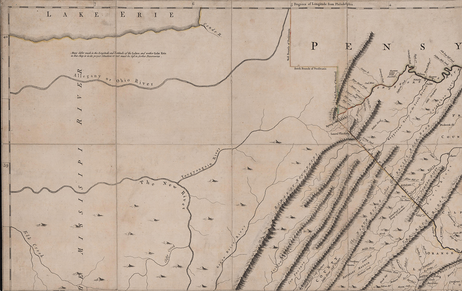 Figure 14 |
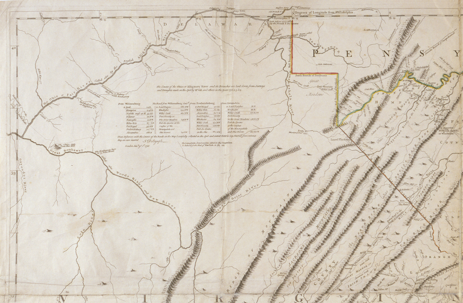 Figure 15 |
The revisions to the western sheets were nothing short of revolutionary. The upper left-hand sheet presents the best depiction of the upper Ohio Valley to appear on any map published during the French and Indian War (Figures 14 and 15). That sheet also includes a table of distances, signed “John Dalrymple, London January 1, 1755.”[46] More importantly, a lengthy notation was included that reads:
The Course of the Ohio or Alligany River and its Branches are laid down from surveys and Draughts made on the spot by Mr. Gist and others in the Years 1751 2 3 & 4.
“Mr. Gist” was the western adventurer, Christopher Gist, the agent for the Ohio Company of Virginia in the Ohio Valley.
The Ohio Company “had no little influence in the final defeat of French interests in North America.”[47] The roster of its members was impressive. By July 1749, when Virginia Lieutenant Governor Gooch, having received special instruction from the King, granted the company permission to take up 200,000 acres west of the Alleghenies, the company had attained its full membership of twenty.[48] The company was the brainchild of Thomas Lee, president of the Virginia Council, who served briefly as Virginia’s acting governor before his death in November 1750 (Figure 16). Lee was the first president of the company and was succeeded by Lawrence Washington. It must have been through the Ohio Company’s influence that Lieutenant Governor Dinwiddie (Figure 17) selected Lawrence’s younger half-brother, George Washington (Figure 18), to be his emissary to the French in 1753. Dinwiddie himself had become a member of the company shortly after he assumed the governorship of Virginia in November 1751. Of all the colonial governors, Dinwiddie was the most strident advocate for armed intervention against the French, and we “will probably never know whether his private interest in protecting the company’s claims or his sense that French control over the Ohio Country posed a threat to settlers in the Virginia back country… motivated Dinwiddie to sound the call for intervention.”[49] Other members of the Ohio Company included Arthur Dobbs, who would be appointed governor of North Carolina in 1753, and John Russell, 4th Duke of Bedford, Secretary for the Southern Department.[50] The company’s London agent was John Hanbury, the largest tobacco merchant of the age, “known to and consulted by cabinet Ministers.”[51]
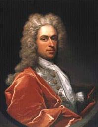 Figure 16 |
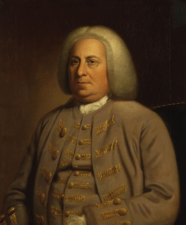 Figure 17 |
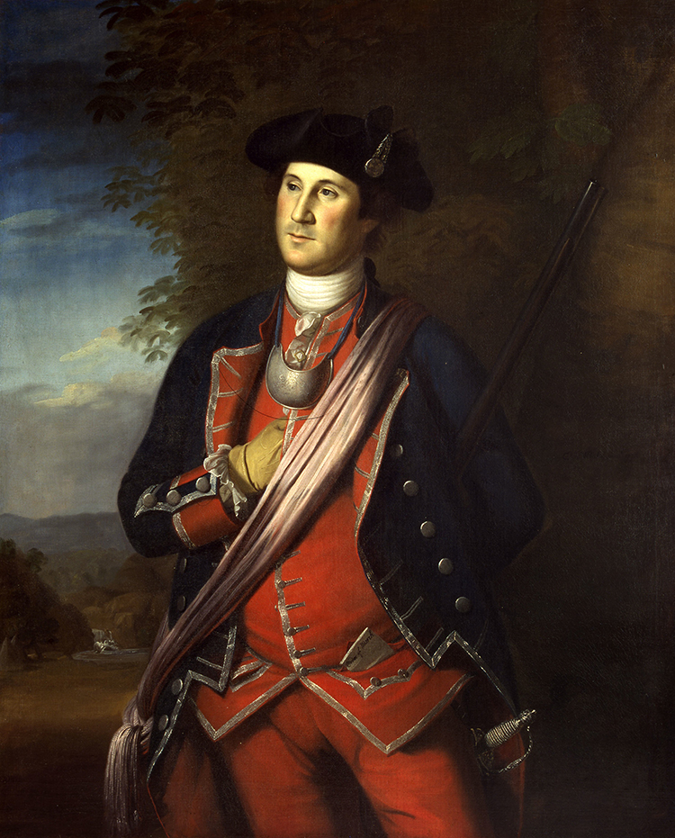 Figure 18 |
In September 1750, the Ohio Company ordered Christopher Gist to the Ohio Valley on a mission to select the lands to be surveyed under the terms of their 1749 land grant.[52] He was instructed “to draw as good a Plan as you can of the Country you pass thro: You are to take an exact and particular Journal of all Your Proceedings, and make a true Report therof to the company.” The plan and journal were “to be returned to the Company upon his oath” (Figure 19).[53]
![Fig. 19: Copy of “Part of the Ohio River… and the courses of Christopher Gist’s first and second tours” from the original 1752 map in the National Archives, Kew, England. Copied by James A. Burt in 1882 for W.M. Darlington. University of Pittsburgh, Darlington Digital Library, DARMAP0610 (available online: http://images.library.pitt.edu/cgi-bin/i/image/image-idx?c=darlmaps;rgn1=ic_all;med=1;button1=Go;q1=gist;back=back1378494107;size=20;subview=detail;resnum=1;view=entry;lastview=thumbnail;cc=darlmaps;entryid=x-darmap0610;viewid=DARMAP0610.TIF [accessed 4 September 2013]).](https://www.mesdajournal.org/wp-content/blogs.dir/23/files/taliaferro-2013/taliaferro-fig-19.jpg)
Figure 19
How did Gist’s resulting “Plan” end up being incorporated into the revised January 1755 state of Fry and Jefferson’s map of Virginia? Verner recognized that Gist’s “journal and map were sent to London where they would have been made available to Thomas Jeffery[s].”[54] He proposed a number of alternatives as to how these documents might have come to Jefferys’s attention, none of them correct. But Verner kept returning to the idea that Gist’s map came into the hands of Joshua Fry and Peter Jefferson and that they were personally responsible for the alterations to the western sheets of the map: “The corrected courses of the Ohio, Kanawha, and New Rivers as well as the French settlements on the Pennsylvania border is derived from the explorations of Christopher Gist which the compilers [Fry and Jefferson] are not apt to have known about until Joshua Fry was in that area with the Virginia forces in the spring of 1754.”[55] In early 1754, Dinwiddie had given Fry command of the Virginia forces ordered to occupy the forks of the Ohio. Before he could fulfill his duty, however, Fry was thrown from his horse and died enroute, at Wills Creek, and the command devolved to Colonel George Washington, his second in command. Washington was immediately defeated and captured at Fort Necessity.
Did Gist give his map to Joshua Fry at Wills Creek in the spring of 1754 as Verner suggested?[56] This theory can be dismissed. Both Gist and the company zealously guarded the contents of both the map and the journal. They would have been particularly loath to have them fall into the hands of Joshua Fry and Peter Jefferson, members of the rival Loyal Company.[57] At any rate, Gist’s journey to Wills Creek can be tracked in a series of letters in the correspondence of Governor Dinwiddie. He was with George Washington at Fort Necessity on 27 May 1754 and with Dinwiddie at Winchester in the Valley of Virginia by 1 June (Figure 20). Gist must have passed through Wills Creek between the 28th and 30th of May, after Fry had been thrown from his horse and was on his deathbed. Fry died on the 31st. It would have made no sense for Gist to give his map to a dying man—a man who was also part of a competing business venture. But the issue is moot. We now know that both map and journal arrived in London months before Gist’s visit to Wills Creek.[58]
![Fig. 20: Christopher Gist’s movements in the Spring of 1754 (image created by the author over the January 1755 [State 3] Fry and Jefferson map [Figure 13]).](https://www.mesdajournal.org/wp-content/blogs.dir/23/files/taliaferro-2013/taliaferro-fig-20.jpg)
Figure 20
The clue to answering how and when Gist’s map and journal arrived in London is found in the papers of the Ohio Company, located in the University of Pittsburgh’s Darlington Library. The papers were edited by Lois Mulkearn and published in 1954 as the George Mercer Papers Relating to the Ohio Company of Virginia. George Mercer succeeded John Hanbury as the company’s London agent. Mercer had been with George Washington at Fort Necessity and would serve the unenviable post of collector for Virginia and Maryland under the Stamp Act in 1765. It is, however, George Mercer’s father, John Mercer, secretary and general counsel to the Ohio Company, who is more central to our interests.[59]
Most of the documents in the Ohio Company’s papers were John Mercer’s work, with either copies or the originals sent to his son George Mercer in London to support the company’s futile effort to obtain final approval for the 200,000-acre land grant.[60] The onset of war in 1754 made it impossible to attempt any survey or settlement west of the Alleghenies. Then, by the Proclamation of 1763, the British government declared all land west of the mountains Indian Territory, closed to English settlement. Competition from other land companies and indifference in London added to the Ohio Company’s troubles.[61]
Despite later failures, optimism must have been high among the Ohio Company’s commissioners in July 1751 when Gist submitted his journal and plan.[62] The company ordered that copies of each be made and sent to Hanbury in London.[63] The task of preparing the copies fell to John Mercer, who refers several times in the company’s papers to “my map.”[64] On 15 June 1753, while Mercer was in Williamsburg, Virginia, to present a petition to the Governor in Council on behalf of the company, an exasperating and discouraging incident occurred. Before the meeting, Mercer loaned “my map” to Governor Dinwiddie “as a member of the Ohio Company…
…upon his promise not to shew it to anybody without my consent, yet when I was called in [to the Council] Colo. Corbin and Colo. Ludwell [councilors] were measuring the distances & taking notes [from the map] in writing. I told them this was not fair for the Map belonged to me as of my own drawing [author’s emphasis] & my instructions by which I drew it cost the company above £600, they delivered it to me but they had done their business, their Entries [for grants] were entered in the Council Books before they left the Room, so that Corbin & Co. in 3 hours time without a shilling charge or Expense except the Clerk of the Council’s fee (which I suppose he dard not charge him) had leave to take up more land than the Ohio Company could obtain in 20yrs Sollicitation & after £10.000 expense.”[65]
Such were the vicissitudes suffered by John Mercer and the Ohio Company.
Mercer’s description of the events in Williamsburg makes it clear that the map the company commissioners ordered to be sent to Hanbury in London was still in his possession in June 1753; furthermore, unless more than one copy was made, it was the same map as that loaned to Dinwiddie.[66] Hanbury was expected to have both the map and journal printed for the use of the company, but the map was never separately printed, and the journal not until 1770. After the January 1755 state of the Fry and Jefferson map was published with the extensively revised western sheets, an irate Mercer believed that Hanbury must have communicated “my map” to some unauthorized person, as it was subsequently “pricked off in the map of Virginia.”[67] Hanbury had indeed communicated the map, but not to any unauthorized person.
On 28 March 1754, Hanbury appeared before the King in Council and presented a petition on behalf of the Ohio Company supported by Mercer’s copies of Christopher Gist’s map and journal. The council referred these documents to the Board of Trade on 2 April 1754. Thus, Mercer’s copy of Christopher Gist’s map came into the hands of the president of the Board of Trade, George Montagu-Dunk, 2nd Earl of Halifax—the same man who in 1749 desired a map to substantiate Britain’s claim to the disputed western lands in America and commissioned John Mitchell’s underwhelming 1750 manuscript map. Within ten months Gist’s map was in print as a revision to Fry and Jefferson’s map of Virginia.[68]
Thomas Jefferys may have had Gist’s map in his workshop as early as the summer of 1754; the re-engraving of the plates was completed in January 1755. The task of transferring Gist’s information to the pattern map must have fallen to John Green (née Braddock Mead), Jefferys’s chief cartographic draftsman. At about the same time, Green compiled his map of Nova Scotia, published by Jefferys in May 1755. Green noted in the accompanying memoir that the map of Nova Scotia was constructed from “previously printed maps and ‘a considerable Number of manuscript Charts, Surveys, Draughts, and Plans… most of which were either communicated to myself, or procured by my Friends.’ ”[69]
Green’s methodology in compiling the map of Nova Scotia mirrors that used for the January 1755 revised Fry and Jefferson. The “previously printed” states of the map, in the form of the pre-existing copperplates, provided a framework. Among the manuscript “Surveys [&] Draughts” used, we can immediately identify Christopher Gist’s map of the Ohio Valley and possibly Fry and Jefferson’s second draught (both created in 1751).[70] We can also identify at least one additional source. The watersheds of the Monongahela and Youghiogheny rivers on the January 1755 state of Fry and Jefferson’s map are completely different from that on Gist’s survey. Green used a 1754 manuscript by an otherwise unidentified “Captain Snow” for that region (Figures 21 and 22). Snow’s map seems to have a Pennsylvania as opposed to a Virginia origin. The map is in the Faden Collection at the Library of Congress, which consists of cartographic material from the archives of the firm of Thomas Jefferys and his successor, William Faden.[71]
![Fig. 21: “Captain Snow’s scetch of the country by himself, and the best accounts he could receive from the Indian traders” by “Captain Snow,” 1754. HOA: 8-1/4", WOA: 13-1/3". Library of Congress, Geography and Map Division, G3820 1754 .S6, Faden Map Collection 4 (available online: http://www.loc.gov/item/gm71000592#about-this-item accessed 4 September 2013]).](https://www.mesdajournal.org/wp-content/blogs.dir/23/files/taliaferro-2013/taliaferro-fig-21.jpg) Figure 21 |
![Fig. 22: Regions compiled from information provided by Christopher Gist and “Captain Snow” (image created by the author over the January 1755 [State 3] Fry and Jefferson map [Figure 13]).](https://www.mesdajournal.org/wp-content/blogs.dir/23/files/taliaferro-2013/taliaferro-fig-22.jpg) Figure 22 |
The Relative Merit of the Revised Fry and Jefferson Compared to Evans’s and Mitchell’s Maps
It is recognized among cartographic scholars that both John Mitchell (Map of the British French Dominions in North America [London, 1755]) (see Fig. 2) and Lewis Evans (Map of the Middle British Colonies [Philadelphia, 1755]) (see Fig. 3) used the Fry and Jefferson map as the source for their depictions of Virginia east of the Blue Ridge Mountains. The Evans and Mitchell maps have long been held to be the best sources for the Ohio Valley at the beginning of the French and Indian War. But, as archivist R.W.G. Vail noted:
…the Ohio Country was already familiar to many fur traders of the adjoining colonies, [but] there had been no carefully written description of the region until Gist’s journals and the maps resulting from his exploration became known in England through Hanbury and the [Ohio] company’s petitions.[72]
Since the surveys of Christopher Gist and Captain Snow were the primary sources for the upper Ohio River and its tributaries on the revised January 1755 state of Fry and Jefferson’s map, the question is: How do they compare with the sources Evans and Mitchell used for their depictions of that region (Figure 23 and 24)? The answer is that they are superior in most respects, a fact that does not seem to have been lost on either Evans or Mitchell. Although the revised Fry and Jefferson preceded their maps into print, their work was too far advanced for them to be able to incorporate any of its new information.[73]
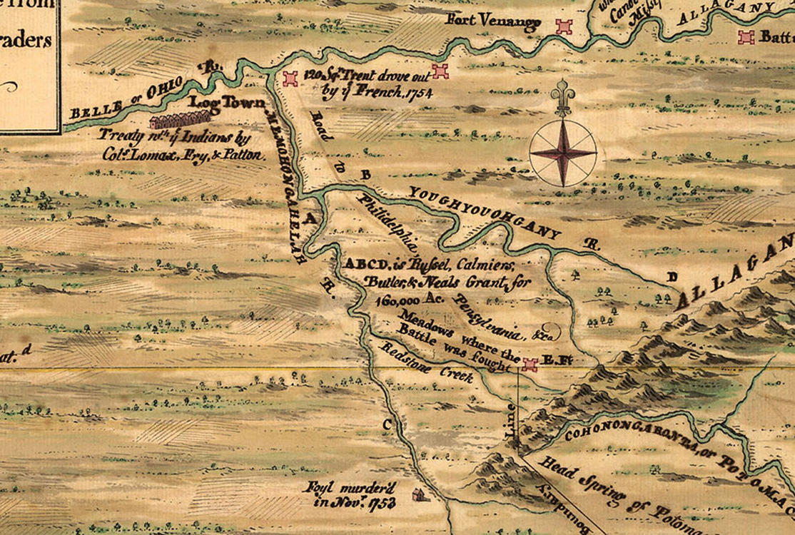 Figure 23 |
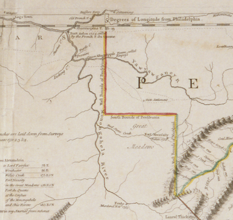 Figure 24 |
Neither Evans nor Mitchell had access to the original survey maps of Gist or Snow. Both Evans and Mitchell evidently made considerable use of a 1752 manuscript map by the Pennsylvania Indian trader John Patten.[74] In January 1756, Evans wrote to R. Dodsley, his London publisher:
Since the publication of my Map, Mr. Gist… was some weeks in Philadelphia. When I shew’d him my Map, he could not be well persuaded at first but [eventually] I had a perusal of his Draught because he could distinctly trace the far greater Number of Places he had been at, and it agreed so well with the Idea he had of the Country.[75]
Evans, however, did have access to a copy of Gist’s journal, from which he extracted some detail. John Mercer subsequently noted that:
…you see Gists tract exactly pricked down in Evan’s map & the distances mentiond in it prove that it was taken exactly from Gist’s Journal & I believe it will be allowed that except that I made off & sent to Mr. Hanbury, Evans’ was the first that ever appeared that could give any tolerable Accot of the Ohio.[76]
Mitchell also had access to Gist’s journal. In his letter to Dodsley, Evans wrote that he showed Mitchell’s map to Gist, with Gist’s:
…Route as laid down thereon. The Route he [Gist] said, had the rivers he crossed, and the creeks he travelled upon; but the Map wanted the Shape his Idea represented to him… Mr. Gist imagined that his Journal became misrepresented in Mitchell’s Map, by the Copy Dr. [sic] Mercer sent of it home from Virginia.[77]
But if the “Shape” was faulty it was because access to Gist’s journal could not compensate for Evans and Mitchell’s lack of access to the visual pattern that the map would have supplied. Evans’s mention of Mercer strongly suggests that the copy of the journal used by Mitchell was the one sent to Hanbury and presented to the King in Council in March 1754. As it had been accompanied by the map, it is surprising that the Board of Trade only supplied Mitchell with the journal.
It is true that both Mitchell and Evans included more of the region than appears on the January 1755 revised Fry and Jefferson. Mitchell laid down the entire course of the Ohio River from its headwaters to its confluence with the Mississippi, and Evans’s detail for the area north of the river is better. But the January 1755 state of Fry and Jefferson’s map is far superior in its scale and depiction of the course of the upper Ohio River. It is richer in human detail for the momentous events of the summer of 1754. As Matthew Edney wrote of John Mitchell’s map, the January 1755 state of the Fry and Jefferson “was very much a product of a particular moment in English politics and Anglo-French imperial rivalry.”[78]
The Fry and Jefferson map also embodied the frustration of the members of the Ohio Company, both for the use of Gist’s map and journal by others and the company’s eventual inability to secure a patent for their 200,000-acre petition. The company’s irritation is best summarized in their 1761 address to the Hanburys:
… it is notorious that till our Discovery the Countrey upon the Ohio… the fatal Consequences of the French Incroachments then were altogether unknown or unattended to. The Inhabitants even of this Colony being utterly unacquainted with the Geography of that Countrey, as is plain from all the late maps published either here or in England [author’s emphasis]—which are actually laid down from the Journals and Discovery’s of our Agents… .[79]
For the upper Ohio Valley, from the mouth of the Kanawha River east to and including the forks—the region where the crucial early events of the French and Indian War occurred—the revised Fry and Jefferson map, drawn on a larger scale, taken from Christopher Gist’s more accurate depiction of the course of the river, and Captain Snow’s excellent map of the area south of the forks, became upon its publication in early 1755 the definitive map for the region in print. At the forks of the Ohio River, the January 1755 state of Fry and Jefferson’s map shows “Fort taken 1754 called by the French Ft. du Quesne.” Flanking Redstone Creek are the “Great Meadows,” with “Fort Necessity taken 1754.” To the north, between the Monongahela and the “Yawyawganey” is “Gists Settlement,” and to the south, on the headwaters of the Monongahela, is “Foyle Murdered Novr 1753.”[80] At Wills Creek, on the banks of the Potomac, are the “Fort [&] Storehouse Ohio Company.” A network of roads and trails crosses the region, including one from Fort Necessity to Wills Creek and then eastward, labeled “[Road] to Philadelphia.”
The Fry and Jefferson map has one of the fundamental depictions of the upper Ohio Valley at the beginning of the French and Indian War. This fact seems to have been better understood by the map’s contemporaries than by recent scholars. The map has a complex relationship to several other key maps of the period. It is interesting to note that in 1759, when Nicholas Scull, surveyor general of Pennsylvania, published the most important map of Pennsylvania of the period, he depended upon the January 1755 state of the Fry and Jefferson map for the location of Fort Cumberland (Wills Creek) and adjusted the southwestern boundary of his own colony to compensate for its position.[81]
Conclusion
Joshua Fry and Peter Jefferson’s Map of the [Most] Inhabited Part of Virginia has long been recognized as the definitive eighteenth-century cartographic document for the colony of Virginia. For the first time, virtually the entire river system of the colony is laid down on a printed map, including the two forks of the Shenandoah River. It is the first to accurately portray the Blue Ridge Mountains, the Valley of Virginia, and the multiple ridges of the Appalachian Mountains, all running diagonally in their true northeast-southwest direction. The colony’s road system is shown for the first time in any detail. The eastern sheets are crowded with the names of planters and their seats, a wealth of information for historians and genealogists. The map remained the prototype for all depictions of Virginia until the nineteenth century.
Recent discoveries substantiate and amplify the importance of Fry and Jefferson’s map far beyond the excellence of its geography for Virginia. Evidence for a formerly unidentified second state has been discovered. Although no example of this printing is known to survive, information provided by the documentary record allows for a major revision to the map’s cartobibliography and suggests when alterations to the map’s eastern sheets may have first appeared in print.
A re-assessment of the historical documents has uncovered the method by which the map was initially constructed and of the sources used for the major revisions to its western sheets published in January 1755. We are now able trace at least one of these sources step-by-step from its frontier origin, to the seat of British colonial power, and finally to the London publishing house of Thomas Jefferys. As a result, we have a clearer picture of how the system that propelled certain colonial surveys and draughts into print worked, as well as a better understanding of the early history of the important firm of Jefferys. Aside from the area devoted to Virginia east of the Alleghenies, almost none of the map’s geography in its final form is the work of Joshua Fry and Peter Jefferson. Those portions of the adjoining colonies that were included, as well as the region west of the Alleghenies, were added from a variety of sources at Jefferys’s workshop.
Fry and Jefferson’s Map of the [Most] Inhabited Part of Virginia is not only one of the key maps in Virginia’s history, but also one of the most important published in Great Britain in the eighteenth century for its insight into British colonial administration and cartographic methodology. In its mature form, the printed map owes as much to a frontier explorer, a group of Virginia land speculators, a British politician, and a cartographic editor as it does to the men whose names it bears.
Henry Taliaferro is a cofounder of Cohen & Taliaferro, dealers in fine antique maps, atlases, globes, and voyage books, has worked with several leading firms in the field, and helped develop some of the most important private and institutional collections in the United States. He is the author of Cartographic Resources, co-author (with Margaret Beck Pritchard) of Degrees of Latitude, and co-editor (with Paul Cohen) of American Cities. He can be reached at [email protected].
APPENDIX A: Comparative Table of the First Seven States (of 9)
|
TALIAFERRO (2013) |
VERNER (1967) |
STEVENS and TREE (1951) |
|
STATE 1 = Aug. 1753 |
STATE 1 = [1753] |
STATE 1 = 1751 |
|
STATE 2 = Dec. 1753 |
——— |
——— |
|
STATE 3 = Jan. 1755 |
STATE 2 = [1754] |
STATE 4 = 1755 |
|
STATE 4 = 1755 |
STATE 3 = [1755] |
STATE 2 = 1751 |
|
STATE 5 = 1755 |
STATE 4 = 1755 |
STATE 3 = 1751 |
|
STATE 6 = 1768 |
STATE 5 = 1768 |
STATE 5 = 176- |
|
STATE 7 = 1775 |
STATE 6 = 1775 |
STATE 6 = 1775 |
• The first five states were separately issued and are quite rare or scarce.
• The 1768 state (Taliaferro’s State 6) was separately-issued and also sold bound into Jefferys and Sayer’s A General Topography, 1768.
• State 7 was included in Jefferys’s American Atlas, published by Sayer and Bennett, 1775 (and later), and is the most common of all the states.
• There are two later states (8 [1782] and 9 [1794]) that are identical except for imprint.
APPENDIX B: Taliaferro’s First Five States
STATE ONE:
August 1753
• Advertised in the London “Public Advertiser,” 13 August 1753: “In a few days will be published…”
• Lacks the word “most” in the title
• Eastern (right-hand) sheets lack road system and other details
• Western (left-hand) sheets are in a very primitive condition
• Copies: University of Virginia, New York Public Library, a private New York collection, Moravian Archives (Winston-Salem, NC)
STATE TWO:
December 1753
• Advertised in the London “Public Advertiser,” 4 December 1753: “This day published…”
• Adds the word “most” to the title
• Copies: None located, but may be an otherwise unrecorded state described by Reverend James Maury in 1755 with the primitive western geography of the first state except for one place name erased; it may also have been the first to include the corrections to the eastern sheets
STATE THREE:
January 1755
• Advertised in the London “Public Advertiser,” 1 January 1755: “In a few days will be published…”
• With the word “most” in the title
• Eastern (right-hand) sheets have the road system and other details added
• Western (left-hand) sheets completely redrawn after “Mr. Gist and others”; table of distances signed “J Dalyrmple”
• Copies: Virginia Historical Society (bequest of Paul Mellon)
STATE FOUR:
1755
• Corrections to degree marks
• Copies: Four identified by Verner, plus others
STATE FIVE:
1755
• Further corrections to degree marks
• Copies: Three identified by Verner, plus others
APPENDIX C: Fry and Jefferson Map Timeline
|
1746 |
John Mitchell goes to London |
|
1747 |
Founding of The Ohio Company of Virginia |
|
1749 |
Founding of the Loyal Company |
|
before 1750 |
Halifax selects Mitchell to make the map of North America |
|
early 1750 |
Mitchell submits his first draught to the Board of Trade |
|
July 1750 |
The Board of Trade directs that a map of each colony be sent to London |
|
Sept. 1750 |
The Ohio Company sends Christopher Gist to the Ohio Valley |
|
Jan. 1751 |
Gov. Burwell informs the Board of Trade that he has selected Fry and Jefferson to make the map of Virginia |
|
July 1751 |
Gist submits his sketch map and journal to the Ohio Company |
|
Aug. 1751 |
Fry and Jefferson’s manuscript map of Virginia sent to London |
|
Dec. 1751 |
Manuscript map of Virginia and Fry’s report submitted to the Board of Trade |
|
April 1752 |
Mitchell submits an analysis of Fry’s report to the Board of Trade |
|
June 1753 |
Gist’s sketch map submitted to the Council of Virginia |
|
Aug. 1753 |
First printing of Fry and Jefferson’s map of Virginia |
|
Dec. 1753 |
Second printing of Fry and Jefferson’s map of Virginia |
|
Early 1754 |
Joshua Fry given command of the Virginia force to be sent to the Ohio |
|
March 1754 |
Hanbury submits a copy of Gist’s map and journal to the King in Council |
|
April 1754 |
The Council refers copy of Gist’s map and journal to the Board of Trade |
|
May 1754 |
Fry dies at Wills Creek |
|
June 1754 |
George Washington surrenders at Fort Necessity |
|
Jan. 1755 |
Third printing of Fry and Jefferson’s map of Virginia |
|
Feb. 1755 |
First printing of John Mitchell’s map of North America |
|
June 1755 |
First printing of Lewis Evans’s map of the Middle British Colonies |
|
July 1755 |
Braddock’s defeat |
|
before Jan. 1756 |
Evans sees Gist’s manuscript |
[1] The author would like to thank the following for their kind assistance and suggestions in compiling this article: Margaret Beck Pritchard, Senior Curator and Curator of Prints, Maps, and Wallpaper, Colonial Williamsburg Foundation; Matthew Edney, Osher Professor in the History of Cartography, University of Southern Maine; the distinguished collectors William Wooldridge and Jay Lester; Michael Buehler, Southampton, MA; and Ashley Baynton-Williams, London. Margaret Pritchard has been a friend and mentor throughout. Matthew Edney guided me with insight and suggestions—and, more importantly, he helped me keep an even hand on the rudder. I am grateful to Jay Lester for informing me of the previously unidentified copy of the first state of the Fry and Jefferson map at the Moravian Archives, Winston-Salem, NC. Ashley Baynton-Williams generously shared his extensive knowledge of English advertisements, which enabled me to form a more accurate picture of the states of the map and the dates when they were published.
[2] The University of Virginia Library’s copy of the August 1753 (State 1) Fry and Jefferson map (Figure 1) is available online: http://search.lib.virginia.edu/catalog/uva-lib:1003260/view (accessed 4 September 2013).
[3] Cooley Verner, “The Fry and Jefferson Map,” Imago Mundi 21 (1967): 70; available online: http://www.jstor.org/stable/1150481 (accessed 20 June 2013).
[4] Verner, “The Fry and Jefferson Map”: 70-94; available online: http://www.jstor.org/stable/1150481 (accessed 20 June 2013). Other sources of note include Richard W. Stephenson and Marianne M. McKee, Virginia in Maps: Four Centuries of Settlement , Growth, and Development (Richmond: Library of Virginia, 2000), 54-55, Map II-21A-D; William C. Wooldridge, Mapping Virginia: From the Age of Exploration to the Civil War (Charlottesville: University of Virginia Press, 2012), 107-111; Margaret Beck Pritchard and Henry G. Taliaferro, Degrees of Latitude: Mapping Colonial America (Williamsburg, VA: Colonial Williamsburg Foundation in association with Harry N. Abrams [New York]), entry 30; William P. Cumming, The Southeast in Early Maps, third edition (Chapel Hill: University of North Carolina Press, 1998), entry 281; Emerson David Fite and Archibald Freeman, A Book of Old Maps Delineating American History from the Earliest Days Down to the Close of the Revolutionary War (Cambridge, MA: Harvard University Press, 1926; reprinted New York: Dover Publications, 1969), 242.
[5] A “state” in cartographic terms refers to a particular printed version of a map, distinguished from other versions by modifications to its content.
[6] Henry Stevens and Roland Tree, Comparative Cartography: Exemplified in an Analytical & Bibliographic Description of Nearly One Hundred Maps and Charts of the American Continent Published in Great Britain During the Years 1600 to 1850, Map Collectors Series (offprint from Essays Honoring Lawrence C. Wroth), vol. 4, no. 39 (1951): 360; available online: http://archive.org/details/comparativecarto00stev (accessed 20 June 2013).
[7] The Library of Congress’s copy of the 1755 Mitchell map (Figure 2) is available online: http://memory.loc.gov/cgi-bin/query/h?ammem/gmd:@field%28NUMBER+@band%28g3300+np000009%29%29 (accessed 4 September 2013). The Library of Virginia’s copy of the 1755 Evans map (Figure 3) is available online: http://digitool1.lva.lib.va.us:8881/R/A3HVK9V649I1K8B3M3RI5K8GFGIT7Y1F7STDT2HBDGTGHITC2C-02217?func=dbin-jump-full&object_id=14989&pds_handle=GUEST (accessed 4 September 2013).
[8] N. Walthoe, “List of Early Land Patents and Grants Petitioned for in Virginia up to 1769, preserved among the Washington Papers,” Virginia Magazine of History and Biography, vol. 5, no. (1897): 241 and National Archives, Kew, England, Public Records Office, CO 5:1333/155. See also, Alfred Proctor James, The Ohio Company: Its Inner History (Pittsburgh, PA: University of Pittsburgh Press, 1959), 5, 9-10; available online: http://digital.library.pitt.edu/cgi-bin/t/text/pageviewer-idx?q1=Ohio%20Company;c=pittpress;rgn1=full%20text;type=simple;button1=Go;cc=pittpress;sort=occur;rgn=full%20text;view=image;seq=0001;idno=31735057893798;didno=31735057893798 (accessed 20 June 2013).
[9] Wilmer L. Hall, ed., Executive Journals of the Council of Colonial Virginia [Nov. 1, 1739-May 7, 1754] [Richmond, State Library of Virginia, 1967), vol. 5, 296-97]).
[10] See Matthew H. Edney, “John Mitchell’s Map of North America (1755): A Study in the Use and Publication of Official Maps in Eighteenth Century Britain,” Imago Mundi 60:1 (2008): 64-66; available online: http://www.jstor.org/stable/40234117 (accessed 20 June 2013). A census of the Board of Trade’s cartographical archives survives from 1780 (see Francis Aegidius Assiotti, List of Maps, Plans, &c. Belonging to the Right Honble. The Lords Commissioners for Trade and Plantations (London: Public Records Office, 1780), held at The National Archives, Kew, England, Public Records Office, CO 326/15 C517272.
[11] Thomas Penn wrote to Richard Peters, 21 February 1755: “Dr. Mitchell is drawing a Map of North America here… assisted by all the Draughts of the Board of Trade, and those of several private People… .” Lawrence Henry Gipson, Lewis Evans (Philadelphia: Historical Society of Pennsylvania, 1939), p. 61. The most detailed account of the relationship between Mitchell and the Board of Trade can be found in Edney, “John Mitchell’s Map” (see note 2). Mitchell’s map is frequently called “The most important map in American history” due to its use at the close of the American Revolution in the negotiations over the boundaries of the new United States. The boundaries of the nation were first laid down on Mitchell’s map. The British copy, the “Red Line Map,” presented to George III, is at the British Library; the American copy, which belonged to John Jay, one of the negotiators, is at the New York Historical Society. See also Edmund Berkeley and Dorothy Smith Berkeley, Dr. John Mitchell: The Man who Made the Map of North America (Chapel Hill: University of North Carolina Press, 1974); Walter W. Ristow, “John Mitchell’s Map of the British and French Dominions in North America,” A La Carte (1972): 103-120; Seymour I. Schwartz and Ralph E. Ehrenberg, The Mapping of America (New York: Harry N. Abrams, 1980), plate 96; and Pritchard and Taliaferro, Degrees of Latitude, entry 33.
[12] Berkeley and Berkeley, Dr. John Mitchell, 182. Both Mitchell and Franklin were disturbed at French encroachments as early as 1744 (Ibid, 62).
[13] Ibid, 3-15.
[14] Edney, “John Mitchell’s Map,” 71-72, citing National Archives, Kew, England, Public Records Office, CO 324/15, fol. 1, 19 July 1750; Verner, “The Fry and Jefferson Map,” 73, citing National Archives, Kew, England, Public Records Office, CO 5/1327, 335. Verner wrote that the Board of Trade requested the map of the colony on “January 15, 1750.” He was mistaken on two counts: He meant 15 January 1751 (new style date) and, according to Edney, citing the above record at the National Archives, the request was made 19 July 1750, a date that agrees with an entry in the Virginia Council Journals (Hall, Executive Journals of the Council of Colonial Virginia, vol. 5, 354]). The 15 January 1750/1 date must be that of Burwell’s reply to the Board of Trade.
[15] Dumas Malone, Jefferson the Virginian (Boston, MA: Little, Brown & Co., 1948), 24, 26.
[16] The history of the Northern Neck of Virginia is too complicated to present here, but the maps of the Northern Neck and the Virginia-North Carolina boundary line completed by Fry and Jefferson, individually or in partnership, were extensions of the earlier work of William Mayo, who was the most important surveyor in Virginia prior to his death in 1744. Mayo was born in England, went to Barbados about 1720, and prepared a survey of Barbados that was published by John Senex in 1722. Mayo shortly went to Virginia where he became the protégé of William Byrd II. Through Byrd’s influence, Mayo made the initial surveys of the first 237 miles of the Virginia-North Carolina boundary line in 1728 and of the Northern Neck in 1737. See William Byrd, History of the Dividing Line (Richmond, 1866), vol. 1, 1-225; vol. 2, 83-139; Fairfax Harrison, Landmarks of Old Prince William (Berryville, VA: Chesapeake Book Co., 1964), 618-629; Pritchard and Taliaferro, Degrees of Latitude, entries 22 and 27; and Cumming, The Southeast in Early Maps, entry 197.
[17] Edney, “John Mitchell’s Map,” 72, citing “Some Additions to the Accounts sent from Virginia, concerning the Extent & Limits of that Colony, and the Encroachments that have been made upon it” in Journal of the Commissioners of Trade & Plantations. January 1749-50 to December 1753 (London: His Majesty’s Stationery Office, 1932), vol. 9, 289; Delf Norona, ed., “Joshua Fry’s Report on the Back Settlements of Virginia (8 May 1751)” The Virginia Magazine of History and Biography, vol. 56 (1948): 22-41; Berkeley and Berkeley, Dr. John Mitchell, 181-82; and National Archives, Kew, England, Public Records Office, CO 5/1327, ff. 429-40.
[18] Edney wrote “early 1753” (“John Mitchell’s Map,” 72), but see the advertisement in the London Public Advertiser for 13 August 1753 (issue 5862): “In a few days will be published, A NEW MAP of the Inhabited Part of Virginia… Drawn by Joshua Fry and Peter Jefferson. Engraved and Published by Thomas Jefferys… .” Verner (“The Fry and Jefferson Map,” 78) established that the map was on sale in Paris in September (“une nouvelle Carte très détaillée & gravée avec beaucoup d’élégance, de la Virginie,” citing M. Maty, Journal Britannique, vol. XII (Septembre-Decembre, 1753): 427-28. I am grateful to Ashley Baynton-Williams for calling the August 1753 ad to my attention.
[19] Edney, “John Mitchell’s Map,” 83, note 53.
[20] The Public Advertiser, 4 December 1753 (issue 5960). Once again I am indebted to Ashley Baynton-Williams for this information.
[21] In the text that accompanied his revision to Lewis Evans’s map, Thomas Pownell notes that Evans based his depiction of Virginia on Fry and Jefferson (the August 1753 state): “The greatest Part of Virginia is composed with the Assistance of Messieurs Fry and Jeffersons Map of it, and as this had the Assistance of actual Surveys of the Division Line with Carolina, and of the Rivers Rapahannock and Potomack from their Entrances to their heads, joined to the Experience of two skilful Persons, it would have been Affectation to have omitted the Advantage of it.” Thomas Pownall, A Topographical Description of the Dominions of the United States of America, edited by Lois Mulkearn (Pittsburgh, PA: University of Pittsburgh Press, 1949), 20.
[22] Letter dated 21 August 1751 and cited by Berkeley and Berkeley, Dr. John Mitchell, 181.
[23] Verner, “The Fry and Jefferson Map,” 73; Thomas Jefferson, Autobiography, 3-4; available online: etext.virginia.edu/toc/modeng/public/JefAuto.html (accessed 4 September 2013).
[24] As Burwell specifically said in his letter of 19 January 1751 to the Board of Trade that he “had employ’d” Fry and Jefferson to make the map, they must have been engaged at some point between 21 November 1750—when Burwell took office—and the following January. Delf Norona argued that the manuscript map was finished when Fry wrote his report dated 8 May 1751. Her argument hinged upon the fact that the manuscript map appears to have been mounted on four blank sheets in the report, but it is possible that is was attached later. Norona, ed., “Joshua Fry’s Report on the Back Settlements of Virginia,” 41.
[25] Norona, ed., “Joshua Fry’s Report on the Back Settlements of Virginia,” 23; for William Mayo, see resources cited in Endnote 16.
[26] Cited by Pritchard and Taliaferro, Degrees of Latitude, entry 37, 186-87. De Brahm’s map was published by Jefferys with a dedication to Halifax. Solicitation was also used by the Spanish Royal Geographer, Tomás López, when compiling his atlas of Spain in the late eighteenth century. López sent a solicitation form, which he styled an “Interview” or “Interrogation,” to local clergy, as in many parts of rural Spain only priests could read and write. A copy of López’s “Interview” survives at the National Library in Madrid. San Antonio Gómez, Carlos de, [&c.] Tomás López un Cartógrafo de Cabinete del Siglo XVIII Fuentes y Metodo de Trabajo; available online: www.ingegraf.es/mesas/COMUNICACIONES%20ACEPTADAS/M2.pdf.
[27] For Herman Boye’s A Map of the State of Virginia (Philadelphia, 1827), see Stephenson and McKee, 121-24 and Wooldridge, Mapping Virginia, 216-19.
[28] Jefferson, with one of the largest libraries and map collections in eighteenth-century North America, was obviously in touch with the map market (J. B. Harley, “The Map User in the Revolution,” in J. B. Harley, Barbara Bartz Petchenik, and Lawrence W. Towner, Mapping the American Revolutionary War [Chicago: University of Chicago Press, 1978], 91). See, for example, Jefferson’s role in the publication of the London edition of the great Cruz Cano map of South America. T. R. Smith, “Cruz Cano’s Map of South America; its creation, adversities and rehabilitation,” Imago Mundi, 20 (1966): 49-78. See also Library of Congress, Catalogue of the Library of Thomas Jefferson, compiled by E. Millicent Sowerby, 5 vols. (Washington, DC: Library of Congress, 1952-1959), 4:85-357, contains a section entitled “Geography.”
[29] Correspondence, “Thomas Jefferson to John Wood, August 7, 1819”, Library of Congress, Thomas Jefferson Papers (available online: http://hdl.loc.gov/loc.mss/mtj.mtjbib023588 [accessed 4 September 2013]). Herman Boye took over the work after Wood’s death in 1822.
[30] Ralph Emmett Fall, ed., The Diary of Robert Rose: A View of Virginia by a Scottish Colonial Parson, 1746-1751 (Verona, VA: McClure Press, 1977), 98. Rose’s plantation, Bear Garden, lay at the forks of the Tye River, in present-day Nelson County, Virginia. The incident is noted by Susan Kern, The Jeffersons at Shadwell (New Haven, CT: Yale University Press, 2010), 166.
[31] Verner, “The Fry and Jefferson Map,” 74, citing a letter of Reverend James Maury, August 1755 (Ann Maury, Memoirs of a Huguenot Family [New York, 1853], 384). Reverend James Maury (1718-1769) was born in Dublin, the son of a French Huguenot, Matthew Maury, and his wife Mary Ann Fontaine, the daughter of Reverend James Fontaine. The family immigrated to Virginia around 1720. James Maury attended the College of William and Mary, and after his ordination as an Anglican minister, he was appointed usher of its grammar school. Maury must have known Fry while at William and Mary. He subsequently served as minister at Fredericksville Parish, Louisa County, Virginia, quite near the homes of both Fry and Jefferson in Albemarle County. Maury ran a private school that Thomas Jefferson attended 1757-1759. He was the grandfather of Matthew Fontaine Maury, the “Pathfinder of the Seas” (Albemarle Adventurers, “James Maury”; online: http://www2.vcdh.virginia.edu/lewisandclark/students/projects/adventurers/maurybio.html (accessed 20 June 2013).
[32] The first draught was still in existence as late as 1780, when it was listed in Assiotti’s census of the Board of Trade’s cartographical archives (Assiotti, List of Maps, Plans, &c.).
[33] Fry notes that Thomas Walker, who in 1750 explored present-day Kentucky for the Loyal Company, “built a house on Cumberland River, as is noted in the map,” meaning the 1751 draught of the Fry and Jefferson (Norona, “Joshua Fry’s Report,” 28, 37). Walker’s house is also shown on Mitchell’s map and on the map Thomas Jefferys added to the 1754 London edition of Washington’s Journal, for which see Norona, “Joshua Fry’s Report,” 29-30, and Pritchard and Taliaferro, Degrees of Latitude, entry 31.
[34] See Hall, Executive Journals of the Council of Colonial Virginia, vol. 5, 354, 370; Fall, The Diary of Robert Rose, 98; and Assiotti, List of Maps, Plans, &c.
[35] See R.A. Skelton, ed., James Cook, Surveyor of Newfoundland: Being a Collection of Charts of the Coasts of Newfoundland and Labradore… London, Thomas Jefferys 1769-1770 (San Francisco: Grabhorn Press, 1965), 7. It is worth noting that Jefferys had been the official geographer to Frederick, Prince of Wales, from 1746 until the latter’s death in 1751, and that the Prince and Halifax ran in the same circles (see Berkeley and Berkeley, Dr. John Mitchell, 162).
[36] Thomas Jefferys, A New Map of Nova Scotia and Great Britain… (London, 1755); although his name does not appear on it, the map was the work of John Green (née Braddock Mead), Jefferys’s principal cartographic draftsman, who also wrote the accompanying memoir Explanation for the New Map of Nova Scotia… (London: Printed for T. Jefferys, 1755). It is almost certain that this map was constructed, at least in part, through the use of the archives of the Board of Trade. J.B. Harley, “The Bankruptsy of Thomas Jefferys: An Episode in the Economic History of Eighteenth Century Map-Making,” Imago Mundi, vol. 20, no. 1 (1966): 27-48, 33-37; available online: http://www.jstor.org/stable/1150407 (accessed 20 June 2013).
[37] The map was described as “embellished with a design by Hayman, and engraved by Grignion.” The Gentleman’s Magazine, vol. 15 (1755): 47 (cited by Pritchard and Taliaferro, Degrees of Latitude, 156, 159 [note 6]). Verner was mistaken in assuming that “Grignion” was Reynolds Grignion, an engraver of lesser stature. His error is followed by Laurence Worms and Ashley Baynton-Williams, British Map Engravers: A Dictionary of Engravers, Lithographers and Their Principal Employers to 1850 (London: Rare Book Society, 2011), 256. This error was corrected in Pritchard and Taliaferro, Degrees of Latitude and by Matthew Edney in private correspondence with this author.
[38] The London Public Advertiser, December 4, 1753 (issue 5960). I am grateful to Ashley Baynton-Williams for calling this advertisement to my attention.
[39] Verner, “The Fry and Jefferson Map,” 85.
[40] The first draught is listed in Assiotti’s 1780 census as “General Map of the inhabited part of Virginia” (Assiotti, List of Maps, Plans, &c., 44).
[41] William Wooldridge essentially came to the same conclusion (Mapping Virginia, 121). In November 1755, Jefferys published John Green’s (née Braddock Meade) four-sheet A Map of the most Inhabited part of New England. In size and format it was intended as a companion to the Fry and Jefferson map, down to the inclusion of the word “most” in its title. See Pritchard and Taliaferro, Degrees of Latitude, entry 35.
[42] Maury, Memoirs of a Huguenot Family, 384. Fairfax Harrison wrote that, “At once, upon publication, a copy of the map came into the hands of Dr. Moses Fontaine, who sent it out [to Virginia] to his nephew James Maury, and asked him to mark upon it the places of residence of the various members of that prolific Huguenot connection” (Harrison, Landmarks of Old Prince William, 632).
[43] This is not surprising as all of the early, separately issued states are quite rare. Just one example of the January 1755 state is known, at the Virginia Historical Society, formerly in the collection of Paul Mellon of Middleburg, Virginia. Mellon bought the map in 1960 from John Fleming, the New York antiquarian bookseller (see Fleming’s 1960 sales catalog, Virginia and her Illustrious Sons). In addition to incorrectly describing this state as the first to include the word “most” in the title, Verner was incorrect when he wrote that it lacked a “two-line note with reference to longitude,” which he believed was added to the following state (Verner’s state 3). A first-hand examination revealed that the note appears on Mellon’s unique example of the January 1755 state. See Verner, “The Fry and Jefferson Map,” 85 (his state 2).
[44] In correspondence to England, August 1755, Reverend James Maury mentioned that two copies of this second draught had been sent to England “by the compilers” (Maury, Memoirs of a Huguenot Family, 378; Verner, “The Fry and Jefferson Map,” 75, 77).
[45] The third printing of the Fry and Jefferson appeared between 1 January and 21 January 1755. See the London Public Advertiser, 1 January 1755 (issue 6283) and the New York Daily Advertiser, 21 January 1755 (pg. 1, col. 3); cited by Verner, “The Fry and Jefferson Map,” 80. Mitchell’s map is dated 13 February 1755, by which time the plates for his map had been finished. Mitchell’s map shows no sign of the geographical revisions that appeared first on the January 1755 state of the Fry and Jefferson. He would have most certainly made some use of them if time had permitted.
[46] Dalrymple was the quartermaster for Joshua Fry’s 1754 western expedition—Verner and others speculated that Fry may have given him Gist’s map and journal at Wills Creek to carry to London (Verner, “The Fry and Jefferson Map,” 76-77). Misled by Dalrymple’s signature under the table of distances on the January 1755 state, some have attributed the revisions on the map to him. Among those that have made the mistake are Lois Mulkern, the editor of Ohio Company’s papers. At one point, Mulkern wrote: “John Dalrymple, who revised the Fry and Jefferson map of Virginia in 1755, [and] also marked Gist’s route on this Map.” This is a curious error for the editor of the Ohio Company papers to make, as the archive contains documents that reveal exactly how the map was revised. Lois Mulkearn, ed., George Mercer Papers Relating to the Ohio Company of Virginia [Pittsburgh, PA: University of Pittsburgh, 1954], 412; available online: http://digital.library.pitt.edu/cgi-bin/t/text/pageviewer-idx?q1=Mulkearn;c=pittpress;rgn1=full%20text;type=simple;button1=Go;cc=pittpress;sort=occur;didno=31735057895066;rgn=full%20text;idno=31735057895066;view=image;seq=0001;node=31735057895066%3A1 (accessed 20 June 2013).
[47] Mulkearn, George Mercer Papers, ix (Foreword by R.W.G. Vail).
[48] Ibid, xi (Introduction).
[49] Fred Anderson, Crucible of War: The Seven Years’ War and the Fate of Empire in British North America, 1754-1766 (New York: Knopf, 2000), 37.
[50] On 20 June 1749, the Ohio Company commissioners wrote to Hanbury that “as we have been told that his Grace the Duke of Bedford has been much our friend in this Affair, we are very desirious that he should be at the head of our Company.” Mulkearn, George Mercer Papers, 140.
[51] Jacob M. Price, “Who Cared About the Colonies? The Impact of the Thirteen Colonies on British Society and Politics, circa 1714-1775,” in Bernard Bailyn and Philip D. Morgan, eds., Strangers within the Realm: Cultural Margins of the First British Empire (Chapel Hill: University of North Carolina Press for the Institute of Early American History and Culture, Williamsburg, Virginia, 1991), 430. For the reliance of the great Virginia planter and councilor, John Custis, on Hanbury’s influence with British officials, see Josephine Little Zupan, ed., The Letterbook of John Custis IV of Williamsburg 1717-1742 (Lanham, MD: Rowman & Littlefield, 2005), 230.
[52] The full text of the grant, with an exact description of the grant’s location, are given in Enclosure IXA to a 6 July 1770 letter of Wills Hill, Earl of Hillsborough, Secretary of State for the Southern Department, to Norborne Berkeley, Baron de Botetourt, Governor of Virginia. The letter did not reach Virginia until after Botetourt’s death in October 1770, when Nelson, as senior member of the council, assumed the office of acting governor. John C. Van Horne, ed., The Correspondence of William Nelson as Acting Governor of Virginia 1770-1771 (Charlottesville: University of Virginia Press, 1975), 46-48.
[53] Mulkearn, George Mercer Papers, 5, 8, 49. A copy of the the plan showing Gist’s routes and the proposed boundaries as petitioned for on November 6, 1752 (Figure 19) is available online: http://images.library.pitt.edu/cgi-bin/i/image/image-idx?c=darlmaps;rgn1=ic_all;med=1;button1=Go;q1=gist;back=back1378494107;size=20;subview=detail;resnum=1;view=entry;lastview=thumbnail;cc=darlmaps;entryid=x-darmap0610;viewid=DARMAP0610.TIF (accessed 4 September 2013).
[54] Verner, “The Fry and Jefferson Map,” 75-76.
[55] Ibid, 75-76.
[56] Wills Creek flows into the Potomac River on the eastern side of the crest of the Alleghenies. The Ohio Company built a fortified storehouse there as the advance base for their operations. In 1755, General Braddock enlarged the compound, thereafter known as Fort Cumberland, and used it as the final staging point for his campaign against Fort Duquesne. William H. Lowdermilk, History of Cumberland (Maryland) (Washington, DC: James Anglim, 1878), 29-31, 88; available online: http://archive.org/details/historycumberla00lowdgoog (accessed 20 June 2013).
[57] Fry sold his share in the Loyal Company to Thomas Walker, 17 February 1753/4 (“Agreement,” Walker and Page Family Papers, 1742-1886, Accession #3098, Special Collections, University of Virginia Library, Charlottesville, Virginia).
[58] R.A. Brock, ed., The Official Records of Robert Dinwiddie, Lieutenant-Governor of the Colony of Virginia, 1751-1758 (Richmond: Virginia Historical Society, 1883), Washington to Dinwiddie, 27 May 1754, vol. 1, 174-75; Dinwiddie to Fry, 29 May 1754, vol. 1, 184-85; Dinwiddie to Washington, 1 June 1754, vol. 1, 186-87.
[59] John Mercer (1704-1768), of Marlborough, Stafford County, Virginia, was admitted to partnership in the Ohio Company on 21 May 1751 (Mulkearn, George Mercer Papers, 6). Born in Dublin, John Mercer was the progenitor of a distinguished Virginia family. He was one of the colony’s leading lawyers, colonial prosecutor for the King’s Court of Virginia, and the author of the Abridgement of Virginia Laws and the First Code of Virginia Laws. James, The Ohio Company, 7-10.
[60] The Ohio Company was continually thwarted by circumstance until its death-knell was sounded by the lapse of its rights in 1771. Lowdermilk, History of Cumberland, 32-33, and Mulkearn, George Mercer Papers, 15-16.
[61] Ibid, 15-16.
[62] Ibid, 49.
[63] Ibid, 51.
[64] Ibid, 225, 305, 411, 526-27, notes 60, 666.
[65] Ibid, 225. On 15 June 1753, Richard Corbin and twenty-four others entered three patents on the south bank of the Ohio River that totaled 190,000 acres (Hall, Executive Journals of the Council of Virginia, vol. 5, 436-7). Corbin had been appointed to the Virginia Council on 19 January 1749/50, at least in part due to the recommendation of John Mitchell to his close friend, the Duke of Argyll, member of the Privy Council (Berkeley and Berkeley, Dr. John Mitchell, 131).
[66] Mulkearn wrote that in the British Museum there is “a plan showing Gist’s routes on his first and second trips, and the proposed boundaries as petitioned for on November 6, 1752.” Mulkearn also located a “holograph map,” at the British National Archives, on which is marked the extent of Gist’s two journeys, “the natural boundaries for their grant, and the road from Wills Creek to a landing on the Monongahela” (“A Larger sketch of the Ohio etc. relating to the Ohio Company’s Lands,” National Archives, Kew, England, CO 700/VIRGINIA13). The National Archives map is probably the same as Large Sketch of part of the Ohio, relating to the Ohio Company, listed by Assiotti (List of Maps, Plans, &c., 1780). “It is not unlikely that, if they were not one and the same, the plan annexed to the petition of March 28, 1754, was a copy of John Mercer’s plan, lent to Dinwiddie… . There is in the Darlington Memorial Library, a tracing made from the original [the PRO map?]… [in] 1882” (Mulkearn, George Mercer Papers, 472-73, note 60). The University of Pittsburgh’s Darlington Library tracing is illustrated in this article as Figure 19. That map has been presented in this article rather than the original (National Archives, Kew, England, CO 700/VIRGINIA13) because it is a much cleaner image and easier to see than the original.
[67] Ibid, 237. Mercer chose a specific cartographic term when he wrote “pricked off”—it means transferring information from one map to another by, literally, sticking pins through the first to mark the second underneath.
[68] Ibid, 470-71 (notes 57 and 58).
[69] Cited by Edney, “John Mitchell’s Map,” 69. For more on the map and memoir of Nova Scotia, see Endnote 36.
[70] The latter was used only if its information had not already been included on the December 1753 printing.
[71] Captain Snow’s Scetch of the Country by Himself and the best accounts He could receive from the Indian Traders 1754 (Figure 21) is available online: http://www.loc.gov/item/gm71000592#about-this-item (accessed 4 September 2013). The Faden Collection also contains a simpler uncolored version of the map (G 3820 1754 .S61 Faden 5; available online: http://www.loc.gov/item/gm71000593 [accessed 4 September 2013]). Both are reproduced in Lloyd Brown, Early Maps of the Ohio Valley (Pittsburgh, PA: University of Pittsburgh Press, 1959), plates 20 and 21. In 1758, Thomas Jefferys published a series of six single-paged maps that depicted Braddock’s march and defeat. One of these is a general Map of the Country between Will’s Creek and Monongahela River that was adapted from the corresponding portion of the January 1755 state of Fry and Jefferson’s map, or perhaps directly from Snow’s map, which Jefferys had in his archives at the time. The remaining five maps were based on manuscript sketches by Braddock’s aide-de-camp, Captain William Orme, which are now held at The British Library. The five printed maps were republished in 1768 in Jefferys and Sayers’s A General Topography of North America. See Seymour I. Schwartz, The French and Indian War 1754-1763 (New York: Simon & Schuster, 1994), figs. 30-30f, 50-55; and Philip Lee Phillips, A List of Geographical Atlases in the Library of Congress (Washington, DC: Library of Congress, 1909), entries 1196, nos. 46-51.
[72] Mulkearn, George Mercer Papers, viii (Foreword by R.W.G. Vail).
[73] Mitchell’s map was published 13 February 1755 and Evans’s map 23 June 1755.
[74] Evans lists a number of the sources he used for the Ohio Valley in the Analysis that accompanied his map but there is no mention of either Gist of Snow. Evans, An Analysis of a General Map of the Middle British Colonies, 10 (reproduced in facsimile in Gipson, Lewis Evans, 141-44). For Patten’s map (the original is in the Library of Congress), see Gipson, Lewis Evans, 57-61; Brown, entry 16, and Howard N. Eavenson, Map Maker & Indian Traders (Pittsburgh, PA: University of Pittsburgh, 1949).
[75] Evans’s letter was published in full in Hazel Shields Garrieson, “Letter of Lewis Evans, January 25, 1756,” Pennsylvania Magazine of History and Biography, 59 (July 1935): 255-83. See also Berkeley and Berkeley, Dr. John Mitchell, 211-12; and Mulkearn, George Mercer Papers, 528-9, note 272.
[76] Mulkearn, George Mercer Papers, p. 297-309, 305.
[77] Berkeley and Berkeley, Dr. John Mitchell, 211-212.
[78] Matthew Edney, “A Publishing History of John Mitchell’s Map of North America, 1755-1775,” Cartographic Perspectives, no. 58 (2007): 4-27 and 71-75.
[79] “the Ohio Company Committee to Capel and Osgood Hanbury,” 10 September 1761, manuscript, Mercer Papers, University of Pittsburgh, PA; available online: http://www.consource.org/document/the-ohio-company-committee-to-capel-and-osgood-hanbury-1761-9-10/20130122083808/ (accessed 20 June 2013). Capel and Osgood Hanbury were the successors to John Hanbury as agent for Ohio Company. The address was most certainly the work of John Mercer, one of the members of the company’s committee.
[80] Robert Files (or Foyle) was one of the first settlers in present-day Randolph County, West Virginia. In November 1753/4, a party of Indians attacked Files’s house and killed him, his wife, and five of their six children. Hu Maxwell, History of Randolph County, West Virginia (Acme Publishing, 1890; reprinted by McClain Print Co., Parsons, WV, 1991), 180.
[81] Nicholas Scull, The Province of Pennsylvania… . (Philadelphia, 1759). See the note beneath the cartouche for attribution. This was the first map of Pennsylvania published in America. Schwartz and Ehrenberg, The Mapping of America, 169; James Clements Wheat and Christian Brun, Maps and Charts Published in America before 1800 (New Haven, CT: Yale University Press, 1969), entry 422.
© 2013 Museum of Early Southern Decorative Arts